Today, Google announced a number of AI-powered sustainability features for end users and public officials, like Flood Hub in the US and Project Green Light.
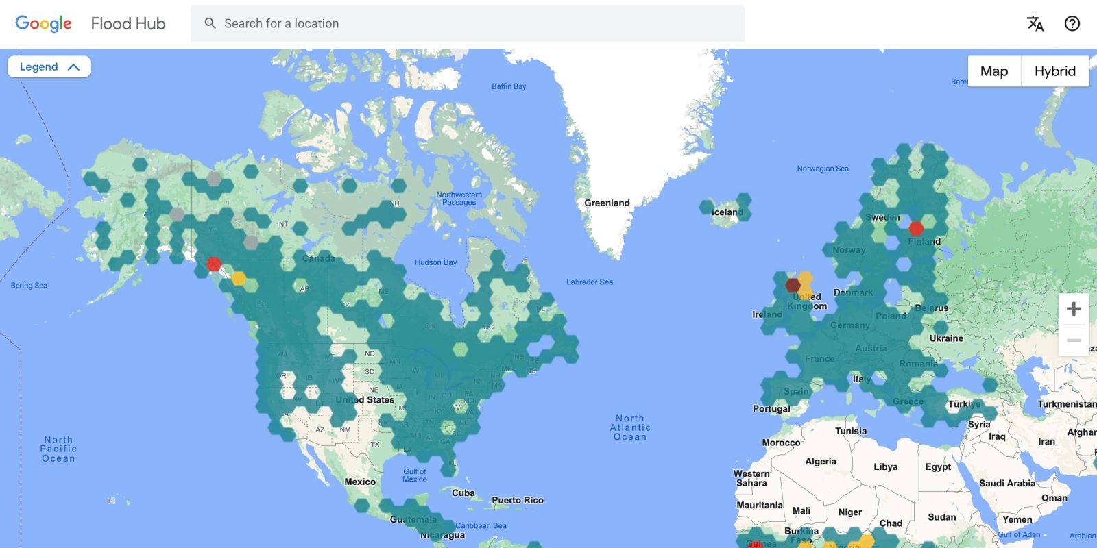
Back in 2018, Google started providing real-time flooding information powered by AI and geospatial analysis. Google is now bringing its Flood Hub riverine flood forecasts to the US and Canada. This covers over 800 locations by rivers where more than 12 million people live. The tool already works in 80 countries.
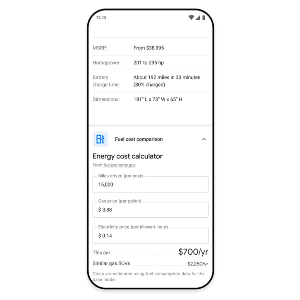
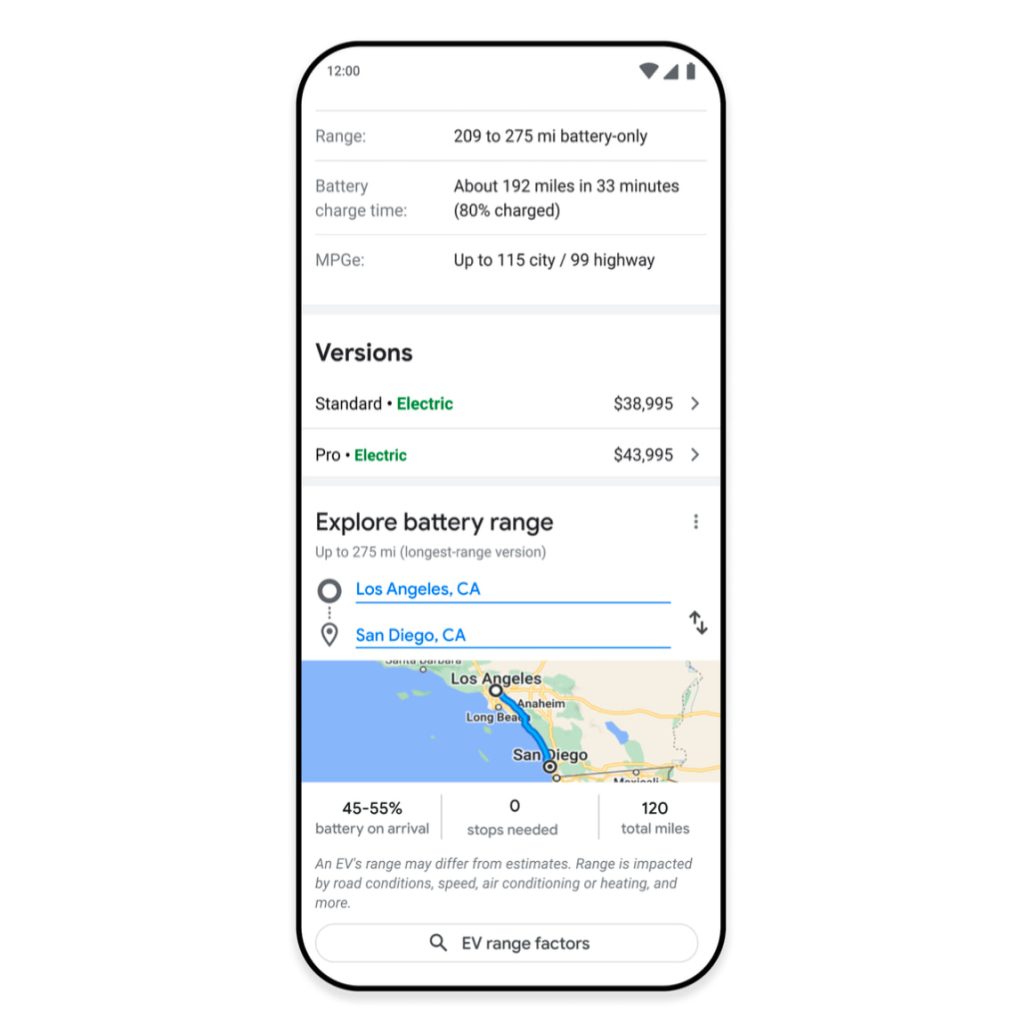
Google Search has added a Fuel Cost Calculator in 21 countries, letting prospective EV buyers compare charging costs with filling up at a gas station. Additionally, you’ll get the ability to “Explore battery range” to see how far a car can go on a single charge.
Drivers can also customize a route to see how many charges are needed along the way based on factors like elevation change and speed limits. These battery range insights roll out in the U.S. in the coming weeks and in Europe early next year.
On the travel front, Search will soon suggest train routes when looking up flights. After coming to the US, Canada, Europe, and Egypt, fuel-efficient routing in Google Maps is coming to India and Indonesia this year with support for two-wheel vehicles. In France, Maps will soon suggest public transit and walking for driving routes if they are “comparable and practical.”
Google will also surface efficiency information and financial incentives when you search for heat pumps and air conditioning units.
Outside of consumer-facing features, Google is releasing new tools for city officials and other public planners. Project Green Light uses AI and Google Maps driving trends to optimize traffic light plans. Recommendations can be used to improve traffic flow and reduce stop-and-go emissions by coordinating nearby intersections to have “waves of green light.” Google imagines the tool helping reduce stops by up to 30%, with availability in more cities next year.
Green Light is now live in 70 intersections in 12 cities from Haifa to Rio de Janeiro to Bangalore – and in these intersections we are able to save fuel and lower emissions for up to 30M car rides monthly.
Google is also collaborating to make the “biggest update in 50 years” to the US Forest Service’s fire spread models. It follows the company’s existing work to track wildfire boundaries.
This model leverages machine learning (ML) to model more fire dynamics to help fire authorities train firefighters, plan effective fuel treatments and battle large-scale fires more safely and effectively while in the field.
FTC: We use income earning auto affiliate links. More.

Comments